superunits_with_maps
Data license: Creative Commons Attribution · Data source: GreenInfo Network · About: simonw/calands-datasette
171 rows where MNG_AGENCY = 16
This data as json, copyable, CSV (advanced)
| Link | rowid ▼ | id | map | ACCESS_TYP | PARK_NAME | PARK_URL | SUID_NMA | MNG_AG_ID | MNG_AGENCY | MNG_AG_LEV | MNG_AG_TYP | AGNCY_WEB | LAYER | ACRES | LABEL_NAME | YR_EST |
|---|---|---|---|---|---|---|---|---|---|---|---|---|---|---|---|---|
| 5126 | 5126 | 5125 | {"type": "Polygon", "coordinates": [[[-118.03024, 34.15973], [-118.02975, 34.15977], [-118.0297, 34.1602], [-118.02916, 34.16008], [-118.02882, 34.16003], [-118.02852, 34.16], [-118.02806, 34.16001], [-118.02952, 34.15919], [-118.03012, 34.15918], [-118.03024, 34.15973]]]} | Restricted Access 2 | Highland Oaks Park | 19930 | 305 | Los Angeles, County of 16 | County 3 | County Agency 3 | http://parks.lacounty.gov | County 3 | 2.854 | Highland Oaks Park | ||
| 5183 | 5183 | 5182 | {"type": "Polygon", "coordinates": [[[-118.27588, 33.85284], [-118.2733, 33.85587], [-118.27289, 33.85501], [-118.27131, 33.85628], [-118.27096, 33.85622], [-118.27087, 33.85665], [-118.26832, 33.85666], [-118.26831, 33.85663], [-118.26621, 33.85662], [-118.26616, 33.85657], [-118.26515, 33.84858], [-118.26738, 33.84759], [-118.26891, 33.84731], [-118.26947, 33.84787], [-118.26991, 33.84825], [-118.26994, 33.84841], [-118.27012, 33.84858], [-118.2705, 33.84889], [-118.27057, 33.84885], [-118.2725, 33.85028], [-118.2731, 33.85068], [-118.27588, 33.85284]]]} | Restricted Access 2 | Victoria Golf Course | 33008 | 305 | Los Angeles, County of 16 | County 3 | County Agency 3 | http://parks.lacounty.gov | County 3 | 167.243 | Victoria GC | ||
| 5319 | 5319 | 5318 | {"type": "Polygon", "coordinates": [[[-118.60165, 34.05301], [-118.60165, 34.05347], [-118.60118, 34.05348], [-118.60118, 34.05301], [-118.60165, 34.05301]]]} | No Public Access 3 | Los Angeles County Open Space | 21480 | 305 | Los Angeles, County of 16 | County 3 | County Agency 3 | http://parks.lacounty.gov | County 3 | 0.547 | Los Angeles County OS | ||
| 5330 | 5330 | 5329 | {"type": "MultiPolygon", "coordinates": [[[[-118.58817, 34.10259], [-118.58777, 34.10269], [-118.58765, 34.10265], [-118.58748, 34.1025], [-118.58813, 34.1025], [-118.58817, 34.10259]]], [[[-118.59194, 34.11026], [-118.59184, 34.11026], [-118.59189, 34.11007], [-118.59189, 34.11009], [-118.59194, 34.11026]]], [[[-118.59261, 34.10389], [-118.59255, 34.10406], [-118.59244, 34.10418], [-118.59221, 34.10403], [-118.59261, 34.10381], [-118.59261, 34.10389]]], [[[-118.59325, 34.10862], [-118.59325, 34.10862], [-118.59278, 34.10857], [-118.59282, 34.10848], [-118.59325, 34.10852], [-118.59325, 34.10862]]], [[[-118.5948, 34.10377], [-118.59468, 34.10378], [-118.59439, 34.10389], [-118.59425, 34.10384], [-118.59396, 34.10385], [-118.59371, 34.10394], [-118.59364, 34.10394], [-118.59358, 34.10367], [-118.59325, 34.10342], [-118.59479, 34.10343], [-118.5948, 34.10377]]], [[[-118.5944, 34.10418], [-118.59438, 34.10445], [-118.59426, 34.10438], [-118.59408, 34.10457], [-118.59412, 34.10471], [-118.59421, 34.1048], [-118.5942, 34.10482], [-118.59417, 34.10483], [-118.59392, 34.10454], [-118.59403, 34.10413], [-118.59407, 34.10419], [-118.5944, 34.10418]]], [[[-118.59516, 34.10385], [-118.59512, 34.10419], [-118.59459, 34.10419], [-118.59461, 34.10385], [-118.59469, 34.10383], [-118.59497, 34.1038], [-118.59516, 34.10385]]], [[[-118.59643, 34.10682], [-118.59624, 34.10711], [-118.59621, 34.1071], [-118.59595, 34.10727], [-118.59594, 34.10729], [-118.59577, 34.10729], [-118.59581, 34.10727], [-118.59609, 34.107], [-118.59614, 34.10674], [-118.596, 34.1067], [-118.59526, 34.10636], [-118.59503, 34.10636], [-118.59501, 34.10609], [-118.59527, 34.10608], [-118.59516, 34.10588], [-118.59545, 34.10588], [-118.59567, 34.10601], [-118.59604, 34.10628], [-118.59629, 34.10655], [-118.59621, 34.10666], [-118.59643, 34.10682]]], [[[-118.59552, 34.10731], [-118.59529, 34.10784], [-118.59516, 34.10784], [-118.59512, 34.10781], [-118.59509, 34.10771], [-118.59506, 34.10767], [-118.59531, 34.10723], [-118.59552, 34.10731]]], [[[-118.59592, 34.10562], [-118.59563, 34.10593], [-118.59545, 34.10584], [-118.59512, 34.10582], [-118.59535, 34.10549], [-118.59546, 34.10556], [-118.59568, 34.1056], [-118.59592, 34.10562]]], [[[-118.59609, 34.10677], [-118.59605, 34.10697], [-118.59583, 34.10719], [-118.59529, 34.10697], [-118.59555, 34.10654], [-118.59598, 34.10675], [-118.59609, 34.10677]]], [[[-118.59762, 34.10679], [-118.59762, 34.10734], [-118.59735, 34.10733], [-118.59731, 34.10683], [-118.59762, 34.10679]]], [[[-118.60065, 34.08186], [-118.60046, 34.08215], [-118.60015, 34.08199], [-118.60027, 34.08183], [-118.60041, 34.08174], [-118.60065, 34.08186]]], [[[-118.60332, 34.08036], [-118.60312, 34.08066], [-118.60292, 34.08071], [-118.60319, 34.08034], [-118.60332, 34.08036]]]]} | Open Access 1 | Los Angeles County Open Space | 21481 | 305 | Los Angeles, County of 16 | County 3 | County Agency 3 | http://parks.lacounty.gov | County 3 | 6.937 | Los Angeles County OS | ||
| 5346 | 5346 | 5345 | {"type": "Polygon", "coordinates": [[[-118.64802, 34.12172], [-118.64795, 34.12533], [-118.64416, 34.12532], [-118.64422, 34.1217], [-118.64802, 34.12172]]]} | Open Access 1 | Los Angeles holding 3 | 21489 | 305 | Los Angeles, County of 16 | County 3 | County Agency 3 | http://parks.lacounty.gov | County 3 | 34.753 | Los Angeles holding 3 | ||
| 5448 | 5448 | 5447 | {"type": "Polygon", "coordinates": [[[-117.9227, 34.54259], [-117.92261, 34.54266], [-117.90969, 34.54268], [-117.90967, 34.53918], [-117.92267, 34.53916], [-117.9227, 34.54259]]]} | Open Access 1 | Jackrabbit Flats Wildlife Sanctuary | 20317 | 305 | Los Angeles, County of 16 | County 3 | County Agency 3 | http://parks.lacounty.gov | County 3 | 114.436 | Jackrabbit Flats Wildlife Sanctuary | ||
| 5467 | 5467 | 5466 | {"type": "Polygon", "coordinates": [[[-118.58186, 34.38143], [-118.5814, 34.38179], [-118.58125, 34.38199], [-118.58102, 34.38221], [-118.58064, 34.38249], [-118.58034, 34.38267], [-118.57979, 34.38198], [-118.57962, 34.38135], [-118.57997, 34.38127], [-118.58047, 34.38112], [-118.58096, 34.38092], [-118.58127, 34.38077], [-118.58185, 34.38136], [-118.58186, 34.38143]]]} | Open Access 1 | Jake Kuredjian Park | 20337 | 305 | Los Angeles, County of 16 | County 3 | County Agency 3 | http://parks.lacounty.gov | County 3 | 5.753 | Jake Kuredjian Park | ||
| 5636 | 5636 | 5635 | {"type": "Polygon", "coordinates": [[[-117.96221, 34.46435], [-117.95784, 34.46435], [-117.95784, 34.46345], [-117.9622, 34.46345], [-117.96221, 34.46435]]]} | Open Access 1 | Juniper Hills Park | 20526 | 305 | Los Angeles, County of 16 | County 3 | County Agency 3 | http://parks.lacounty.gov | County 3 | 9.914 | Juniper Hills Park | ||
| 6103 | 6103 | 6102 | {"type": "Polygon", "coordinates": [[[-118.35905, 33.9381], [-118.35751, 33.93811], [-118.3575, 33.93775], [-118.35755, 33.93773], [-118.35756, 33.93669], [-118.35857, 33.93669], [-118.3586, 33.93651], [-118.35905, 33.93651], [-118.35905, 33.9381]]]} | Open Access 1 | Lennox Park | 21163 | 305 | Los Angeles, County of 16 | County 3 | County Agency 3 | http://parks.lacounty.gov | County 3 | 5.63 | Lennox Park | ||
| 6378 | 6378 | 6377 | {"type": "Polygon", "coordinates": [[[-118.65013, 34.12534], [-118.65007, 34.12907], [-118.64741, 34.12906], [-118.64738, 34.12533], [-118.65013, 34.12534]]]} | Open Access 1 | Los Angeles holding 4 | 21491 | 305 | Los Angeles, County of 16 | County 3 | County Agency 3 | http://parks.lacounty.gov | County 3 | 25.538 | Los Angeles holding 4 | ||
| 6379 | 6379 | 6378 | {"type": "Polygon", "coordinates": [[[-118.63309, 34.12589], [-118.63308, 34.12624], [-118.63243, 34.12624], [-118.63244, 34.12598], [-118.63309, 34.12589]]]} | Open Access 1 | Los Angeles holding 5 | 21492 | 305 | Los Angeles, County of 16 | County 3 | County Agency 3 | http://parks.lacounty.gov | County 3 | 0.502 | Los Angeles holding 5 | ||
| 6380 | 6380 | 6379 | {"type": "Polygon", "coordinates": [[[-118.16425, 34.20803], [-118.16421, 34.20806], [-118.16415, 34.20814], [-118.16402, 34.20843], [-118.16389, 34.20862], [-118.16381, 34.2087], [-118.16379, 34.20873], [-118.16361, 34.20889], [-118.1632, 34.20918], [-118.16302, 34.20934], [-118.16292, 34.20946], [-118.16283, 34.20965], [-118.16273, 34.20979], [-118.16243, 34.21008], [-118.16238, 34.21009], [-118.1623, 34.21009], [-118.1622, 34.21004], [-118.16216, 34.20998], [-118.16216, 34.20979], [-118.16218, 34.2096], [-118.16225, 34.20936], [-118.16241, 34.20908], [-118.16248, 34.20891], [-118.16251, 34.20874], [-118.1625, 34.20838], [-118.16293, 34.208], [-118.16425, 34.20803]]]} | Open Access 1 | Los Angeles holding 6 | 21493 | 305 | Los Angeles, County of 16 | County 3 | County Agency 3 | http://parks.lacounty.gov | County 3 | 5.181 | Los Angeles holding 6 | ||
| 6381 | 6381 | 6380 | {"type": "Polygon", "coordinates": [[[-118.16322, 34.20967], [-118.16308, 34.21031], [-118.16183, 34.21032], [-118.1618, 34.20908], [-118.16226, 34.2091], [-118.16218, 34.20921], [-118.16211, 34.20936], [-118.16205, 34.20958], [-118.16203, 34.20973], [-118.16203, 34.21], [-118.16209, 34.2101], [-118.1622, 34.21018], [-118.16229, 34.2102], [-118.1624, 34.2102], [-118.16254, 34.21014], [-118.16284, 34.20986], [-118.16294, 34.20972], [-118.16298, 34.20963], [-118.16322, 34.20967]]]} | Open Access 1 | Los Angeles holding 7 | 21494 | 305 | Los Angeles, County of 16 | County 3 | County Agency 3 | http://parks.lacounty.gov | County 3 | 1.731 | Los Angeles holding 7 | ||
| 6382 | 6382 | 6381 | {"type": "Polygon", "coordinates": [[[-118.60788, 34.06942], [-118.60718, 34.06977], [-118.60688, 34.06935], [-118.60758, 34.069], [-118.60788, 34.06942]]]} | Open Access 1 | Los Angeles holding 8 | 21495 | 305 | Los Angeles, County of 16 | County 3 | County Agency 3 | http://parks.lacounty.gov | County 3 | 1.023 | Los Angeles holding 8 | ||
| 6405 | 6405 | 6404 | {"type": "Polygon", "coordinates": [[[-118.61573, 34.06931], [-118.61507, 34.06932], [-118.61506, 34.06843], [-118.61534, 34.06856], [-118.6155, 34.0687], [-118.61554, 34.06878], [-118.61559, 34.06896], [-118.61573, 34.06931]]]} | Open Access 1 | Los Angeles holding 10 | 21485 | 305 | Los Angeles, County of 16 | County 3 | County Agency 3 | http://parks.lacounty.gov | County 3 | 1.032 | Los Angeles holding 10 | ||
| 6407 | 6407 | 6406 | {"type": "Polygon", "coordinates": [[[-118.16406, 34.20859], [-118.16399, 34.20877], [-118.16379, 34.20908], [-118.16333, 34.20952], [-118.16322, 34.20967], [-118.16298, 34.20963], [-118.16307, 34.20948], [-118.16318, 34.20935], [-118.16368, 34.20899], [-118.16383, 34.20886], [-118.16406, 34.20859]]]} | Open Access 1 | Los Angeles holding 11 | 21486 | 305 | Los Angeles, County of 16 | County 3 | County Agency 3 | http://parks.lacounty.gov | County 3 | 0.54 | Los Angeles holding 11 | ||
| 6424 | 6424 | 6423 | {"type": "Polygon", "coordinates": [[[-117.98692, 34.00896], [-117.98596, 34.01059], [-117.98499, 34.01019], [-117.98594, 34.00856], [-117.98692, 34.00896]]]} | Open Access 1 | Los Robles County Park | http://parks.lacounty.gov/wps/portal/dpr/Parks/Los_Robles_Park | 21532 | 305 | Los Angeles, County of 16 | County 3 | County Agency 3 | http://parks.lacounty.gov | County 3 | 4.991 | Los Robles County Park | |
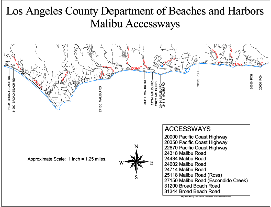
| 6544 | 6544 | 6543 | {"type": "Polygon", "coordinates": [[[-118.69582, 34.03263], [-118.69528, 34.03266], [-118.69505, 34.03271], [-118.6947, 34.03275], [-118.69402, 34.03276], [-118.69361, 34.03274], [-118.69304, 34.03271], [-118.69301, 34.03265], [-118.69217, 34.03259], [-118.69139, 34.03251], [-118.69089, 34.03241], [-118.69007, 34.0323], [-118.68928, 34.03212], [-118.68611, 34.03148], [-118.68533, 34.03129], [-118.68403, 34.03101], [-118.68372, 34.03091], [-118.68288, 34.03084], [-118.68266, 34.03086], [-118.68266, 34.03076], [-118.68257, 34.03045], [-118.68313, 34.03031], [-118.68348, 34.03033], [-118.68369, 34.0304], [-118.6849, 34.03055], [-118.68539, 34.03067], [-118.68642, 34.03102], [-118.68665, 34.03113], [-118.68749, 34.03137], [-118.68918, 34.03178], [-118.69, 34.03201], [-118.6913, 34.03228], [-118.69179, 34.03235], [-118.6925, 34.03243], [-118.69339, 34.03249], [-118.69571, 34.03238], [-118.69582, 34.03263]]]} | Open Access 1 | Malibu Beach | http://file.lacounty.gov/dbh/cms1_151453.jpg | 21699 | 305 | Los Angeles, County of 16 | County 3 | County Agency 3 | http://parks.lacounty.gov | County 3 | 12.354 | Malibu Beach | |
| 6550 | 6550 | 6549 | {"type": "MultiPolygon", "coordinates": [[[[-118.67646, 34.03707], [-118.67629, 34.03715], [-118.67638, 34.03729], [-118.67622, 34.03728], [-118.6754, 34.0376], [-118.67481, 34.0378], [-118.67474, 34.03767], [-118.67555, 34.03741], [-118.6763, 34.03706], [-118.67642, 34.03702], [-118.67646, 34.03707]]], [[[-118.68069, 34.03475], [-118.68034, 34.03486], [-118.67997, 34.03502], [-118.67962, 34.0352], [-118.6793, 34.03539], [-118.67884, 34.03574], [-118.67771, 34.0367], [-118.67744, 34.03647], [-118.67726, 34.03661], [-118.67677, 34.03691], [-118.67665, 34.03693], [-118.67654, 34.03698], [-118.67647, 34.03688], [-118.67663, 34.03681], [-118.67677, 34.03672], [-118.67699, 34.03656], [-118.67734, 34.03625], [-118.6779, 34.03553], [-118.67822, 34.03495], [-118.67858, 34.0341], [-118.67889, 34.03394], [-118.67915, 34.03376], [-118.67926, 34.03353], [-118.67958, 34.03389], [-118.67912, 34.03417], [-118.67883, 34.03473], [-118.67917, 34.03516], [-118.67947, 34.03501], [-118.67978, 34.03488], [-118.67983, 34.03492], [-118.6801, 34.03483], [-118.68027, 34.0348], [-118.68066, 34.03468], [-118.68069, 34.03475]]], [[[-118.68268, 34.03131], [-118.682, 34.03166], [-118.68189, 34.0319], [-118.68113, 34.03114], [-118.68152, 34.03111], [-118.68266, 34.03076], [-118.68268, 34.03131]]]]} | Open Access 1 | Malibu Lagoon State Beach | http://www.parks.ca.gov/?page_id=835 | 21710 | 305 | Los Angeles, County of 16 | County 3 | County Agency 3 | http://parks.lacounty.gov | County 3 | 9.808 | Malibu Lagoon SB | 1951 |
| 6579 | 6579 | 6578 | {"type": "MultiPolygon", "coordinates": [[[[-118.41225, 33.88391], [-118.41199, 33.884], [-118.41173, 33.88354], [-118.41133, 33.88366], [-118.41018, 33.88154], [-118.40989, 33.88096], [-118.40823, 33.87745], [-118.40839, 33.87739], [-118.40924, 33.87918], [-118.40841, 33.87738], [-118.40916, 33.87712], [-118.40966, 33.87693], [-118.41175, 33.88137], [-118.411, 33.88164], [-118.41113, 33.88191], [-118.4115, 33.88254], [-118.41173, 33.883], [-118.41197, 33.88339], [-118.41218, 33.88381], [-118.41225, 33.88391]], [[-118.41001, 33.88078], [-118.40999, 33.88078], [-118.41033, 33.88148], [-118.41056, 33.88188], [-118.41001, 33.88078]]], [[[-118.42323, 33.90491], [-118.42228, 33.90523], [-118.42225, 33.90519], [-118.4221, 33.90523], [-118.42152, 33.90405], [-118.42166, 33.90401], [-118.42166, 33.90399], [-118.42164, 33.90397], [-118.4215, 33.90402], [-118.42092, 33.90283], [-118.42105, 33.90279], [-118.42106, 33.90276], [-118.42089, 33.9028], [-118.42035, 33.90165], [-118.42008, 33.90105], [-118.42007, 33.90101], [-118.42022, 33.90096], [-118.42049, 33.9016], [-118.42051, 33.9016], [-118.42057, 33.90175], [-118.42063, 33.90175], [-118.42001, 33.90033], [-118.42, 33.90022], [-118.41997, 33.90016], [-118.41992, 33.90017], [-118.41993, 33.90024], [-118.41975, 33.90028], [-118.4195, 33.89971], [-118.41965, 33.89966], [-118.41979, 33.89998], [-118.41985, 33.90004], [-118.4199, 33.90001], [-118.4198, 33.89983], [-118.41969, 33.89958], [-118.4184, 33.8966], [-118.41753, 33.89465], [-118.41668, 33.8929], [-118.41606, 33.89174], [-118.41602, 33.89177], [-118.41626, 33.89225], [-118.41611, 33.89231], [-118.41552, 33.89116], [-118.41567, 33.89111], [-118.41572, 33.89106], [-118.41344, 33.88697], [-118.4128, 33.88585], [-118.41274, 33.88585], [-118.41295, 33.88626], [-118.41295, 33.88627], [-118.41297, 33.88628], [-118.41359, 33.88737], [-118.41344, 33.88742], [-118.41282, 33.88633], [-118.41284, 33.88629], [-118.4128, 33.88622], [-118.41276, 33.88623], [-118.41227, 33.88536], [-118.41266, 33.88521], [-118.41227, 33.88449], [-118.41327, 33.88415], [-118.41391, 33.88545], [-118.41474, 33.88698], [-118.41574, 33.88877], [-118.41766, 33.89243], [-118.41943, 33.89618], [-118.42024, 33.89803], [-118.42108, 33.89989], [-118.42186, 33.90174], [-118.42323, 33.90491]]], [[[-118.41459, 33.88916], [-118.41443, 33.88922], [-118.41415, 33.88868], [-118.41413, 33.88867], [-118.41349, 33.88752], [-118.41365, 33.88747], [-118.41428, 33.88861], [-118.41427, 33.88863], [-118.41429, 33.88863], [-118.41459, 33.88916]]], [[[-118.41558, 33.89096], [-118.41543, 33.89101], [-118.4148, 33.88987], [-118.41481, 33.88985], [-118.41479, 33.88985], [-118.41449, 33.88932], [-118.41465, 33.88926], [-118.41493, 33.88981], [-118.41495, 33.88982], [-118.41528, 33.8904], [-118.41528, 33.89042], [-118.41558, 33.89096]]], [[[-118.41656, 33.89282], [-118.41642, 33.89287], [-118.41614, 33.89234], [-118.41628, 33.89228], [-118.41656, 33.89282]]], [[[-118.41687, 33.89344], [-118.41673, 33.89349], [-118.41646, 33.89297], [-118.41661, 33.89292], [-118.41687, 33.89344]]], [[[-118.41716, 33.89404], [-118.41704, 33.89408], [-118.41675, 33.89352], [-118.41688, 33.89347], [-118.41716, 33.89404]]], [[[-118.41746, 33.89466], [-118.41731, 33.89471], [-118.41709, 33.89418], [-118.41722, 33.89415], [-118.41746, 33.89466]]], [[[-118.41829, 33.89652], [-118.41814, 33.89657], [-118.4179, 33.89599], [-118.41788, 33.89599], [-118.41736, 33.89482], [-118.41751, 33.89477], [-118.41775, 33.89532], [-118.41777, 33.89532], [-118.41829, 33.89652]]], [[[-118.4191, 33.89838], [-118.41895, 33.89843], [-118.41819, 33.89667], [-118.41834, 33.89662], [-118.4191, 33.89838]]], [[[-118.41964, 33.89964], [-118.41949, 33.89969], [-118.419, 33.89853], [-118.41915, 33.89849], [-118.41964, 33.89964]]], [[[-118.42017, 33.90087], [-118.42002, 33.90091], [-118.4198, 33.90039], [-118.41995, 33.90035], [-118.42017, 33.90087]]]]} | Open Access 1 | Manhattan County Beach | 21746 | 305 | Los Angeles, County of 16 | County 3 | County Agency 3 | http://parks.lacounty.gov | County 3 | 96.071 | Manhattan County Beach |
Advanced export
JSON shape: default, array, newline-delimited
CREATE TABLE superunits_with_maps(
  id INT,
  map,
  ACCESS_TYP INT,
  PARK_NAME TEXT,
  PARK_URL TEXT,
  SUID_NMA INT,
  MNG_AG_ID INT,
  MNG_AGENCY INT,
  MNG_AG_LEV INT,
  MNG_AG_TYP INT,
  AGNCY_WEB TEXT,
  LAYER INT,
  ACRES REAL,
  LABEL_NAME TEXT,
  YR_EST INT,
   FOREIGN KEY([ACCESS_TYP]) REFERENCES [ACCESS_TYP]([id]),
   FOREIGN KEY([MNG_AGENCY]) REFERENCES [MNG_AGENCY]([id]),
   FOREIGN KEY([MNG_AG_LEV]) REFERENCES [MNG_AG_LEV]([id]),
   FOREIGN KEY([MNG_AG_TYP]) REFERENCES [MNG_AG_TYP]([id]),
   FOREIGN KEY([LAYER]) REFERENCES [LAYER]([id])
);
CREATE INDEX [idx_superunits_with_maps_LAYER]
    ON [superunits_with_maps] ([LAYER]);
CREATE INDEX [idx_superunits_with_maps_MNG_AG_TYP]
    ON [superunits_with_maps] ([MNG_AG_TYP]);
CREATE INDEX [idx_superunits_with_maps_MNG_AG_LEV]
    ON [superunits_with_maps] ([MNG_AG_LEV]);
CREATE INDEX [idx_superunits_with_maps_MNG_AGENCY]
    ON [superunits_with_maps] ([MNG_AGENCY]);
CREATE INDEX [idx_superunits_with_maps_ACCESS_TYP]
    ON [superunits_with_maps] ([ACCESS_TYP]);